MSDI Hydrography
 The MSDI Hydrography framework stores networked geometry and attributes representing the surface water in Montana (lakes, ponds, streams, rivers, canals, ditches, etc.). This data is controlled and managed by the USGS, though edits to features within Montana are made by the MSDI Hydrography theme lead (or designee).
Data and Documentation
MSDI Hydrography Data
The Montana Hydrography dataset is the high resolution (1:24K) National Hydrography Dataset in geodatabase and shapefile formats projected to the Montana State Plane Coordinate System. View an interactive web map of the data here.
MSDI Hydrography Web Service
This statewide map service provides viewing and querying access to the hydrography dataset for use in web applications and desktop GIS software.
NHD Database Documentation
For more information on the structure of the NHD Geodatabase, see the NHD User Guide and the database schema version 2.3.1. The Montana State Library provides exercise tutorials and presentations or contacts us for assistance or to schedule a training. We would be glad to help. Additional documentation and tutorials can be found through the USGS NHD website.
Applications
The National Map Advanced Viewer
The National Map online mapping application is maintained by the USGS. It provides a viewer and download platform to visualize, identify, and download the National Hydrography Dataset, as well as other spatial data, such as elevation, land cover, and structures.
Montana's 3DHP Planning Dashboard
The Montana 3DHP Dashboard is a is a planning tool for prioritizing Montana watersheds (HU8/HU10) for watercourse mapping modernization through the 3DHP. Use the dashboard to track the status of 3DHP, identify watershed areas of interest and potential partners, and gather preliminary (unofficial) cost estimates.
Montana Hydrography Working Group
The Hydrography Working Group is open to all and meets regularly to discuss statewide hydrography and water-related data needs.
Meetings
Next meeting: TBD
Previous meeting: May 1, 2025, online (Zoom)
Subscribe to MSL's GovDelivery to receive future meeting invites, announcements, and other news.
About
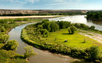
Hydrography includes surface water features such as lakes, ponds, streams, rivers, canals, and ditches. Hydrography is important to many applications. As with other data themes, many users need hydrographic features as reference or base map data. Other applications, particularly environmentally oriented analyses, need the information for analysis and modeling of water quality, water supply, pollution, flood hazard assessment, fish and wildlife, water rights, development, and land suitability.
The NHD is a comprehensive set of digital spatial data that contain information about surface water features such as lakes, ponds, streams, rivers, springs and wells. The NHD is the surface water feature data component of the USGS National Map. Within the NHD, surface water features are combined to form "reaches," which provide the framework for linking water-related data to the NHD surface water drainage network. These linkages enable the analysis and display of water-related data in upstream and downstream order.
Theme Lead
Troy Blandford
Montana State Library
tblandford@mt.gov
(406) 444-7930
