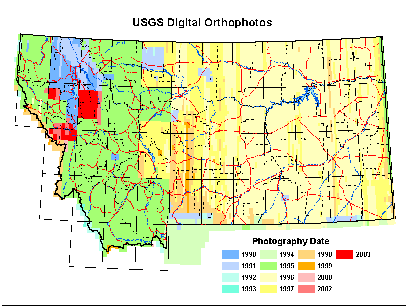
Aerial Photos of Montana, 1990-2003
USGS Digital Orthophoto Quarter Quadrangle Data(DOQQ)
Zoom to your area of interest on the map below and the quadrangle boundaries will appear. Click on a quadrangle to bring up links to download the images. Zoom closer to see the dates of the four quarter-quadrangles that were combined to create each quadrangle image. Please see the explanation below the map for information about the products that are available.
The images are in MrSID format and a file in State Plane coordinates is available for every quadrangle. Many quadrangles are also available in UTM coordinates (NAD27).
These data are available as a web service that allows seamless access to imagery of the full state without the need to download individual tiles
View Larger Map- If the UTM image link does not work, it means we do not have a UTM image for the quadrangle. All of the State Plane links should work.
- The images do not contain spatial reference information. If you want to use the images with coordinate systems other than UTM or State Plane NAD83 meters, you must use your software to set their coordinate system properties.
- Some GIS software may require the world files to georeference the images.
- The images have light-colored areas around the edges that represent nodata or null values which will obscure the view of adjacent images. In ArcMap 10, the only solution for making the edges transparent is to set the image symbology to show Unique Values with a black-to-white color scheme and then set the properties of the 10 or 15 brightest colors to "No Color". To do this, ArcMap will require you to let it build a value attribute table for the image.
DOQQ Header Files
- These files contain the image headers from the USGS DOQQ files. The headers identify the photographs and processes that were used to create the images.
- The headers contain information specific to the format and size of the original USGS image files. This information is not applicable to these reprocessed files.
- We don't have headers for all of our images, especially for quadrangles outside of Montana. If the header links do not work, we do not have a header for the image.
Please see our Ordering Aerial Photos page if you need a large number of these images, if you require images with an infrared band, or if you require the images in TIFF format.
The approximate horizontal accuracy of these images is 5 meters.
