MSDI Elevation
 The accepted framework layer for the elevation dataset in Montana is the USGS National Elevation Dataset. The National Elevation Dataset (NED) is a raster product assembled by the U.S. Geological Survey. Both the one arc-second (approximately 30-meter) and one third arc-second (approximately 10 meter) data have been collected and processed for the extent of Montana. NED data access (DEMs)
Data and Documentation
- Montana Lidar Inventory - View, download, and request lidar data and collaborate on future lidar acquisitions. Explore how lidar is used in Montana.
- Montana Lidar Plan (June 2019) - Read the Montana Lidar Plan
Applications
- Relative Elevation Models - Explore Montana rivers and streams using LiDAR-derived relative elevation models.
- United States Interagency Elevation Inventory - A nationwide listing of known publicly available high-accuracy topographic and bathymetric source elevation data.
- SeaSketch - U.S. Federal Mapping Coordination - view priority areas for lidar acquisitions submitted by Federal and State agencies.
Montana Elevation Working Group
The Elevation Working Group is open to all and meets regularly to discuss statewide elevation and lidar needs.
Meetings
Next meeting: TBD
Previous meeting: May 1, 2025, online (Zoom)
Subscribe to MSL's GovDelivery to receive future meeting invites, announcements, and other news.
Past meeting agendas and materials: 06/28/2022 | 08/10/2021 | 10/2020 | 01-24-2019 | 11-02-2018 | 09-25-2018
About
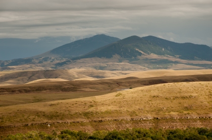
Elevation data is a digital representation of spatially-referenced vertical positions above or below a datum surface. The data is most often used in grid (raster) form or via contour line data illustrating the elevation of the earth’s surface at defined intervals. Traditional Elevation Data is provided for use as products as well as source elevation data. Products include Digital Elevation Models (DEM), Digital Surface Models (DSM), Contours, and ancillary elevation products such as shaded relief maps. Source elevation data includes data like lidar point clouds (LPC) and ifsar radar returns.
Shaded Relief elevation data for visualization purposes is one of the most widely used geospatial data themes in the world. Elevation data is also used to model water flow, mass movement of material (avalanches and landslides), line of sight analysis, and flight simulation rectification of aerial photography, gravity measurements, and terrain analysis.
For reference, the two technologies identified below are commonly used to generate enhanced elevation source data capable of producing higher quality elevation data products (DEM, contours, etc.) and higher quality source data, enabling higher quality spatial analysis:
- LiDAR—(Light Detection and Ranging): airborne lidar is a remote sensing method that uses light in the form of a pulsed laser to measure ranges (variable distances) to the Earth. These light pulses—combined with other data recorded by the airborne system— generate precise, three-dimensional information about the shape of the Earth and its surface characteristics.
- IfSAR—(Interferometric Synthetic Aperture Radar): airborne ifsar is a remote sensing method using radar. This mapping method uses two or more synthetic aperture radar (SAR) images to generate maps of surface deformation or digital elevation, using differences in the phase of the waves returning to the aircraft.
High-resolution Elevation Data and the 3D Elevation Program (3DEP)
The Montana State Library became the steward of MSDI Elevation in 2018. Efforts are underway to develop a Statewide Lidar Plan and identify how to best leverage the USGS 3D Elevation Program (3DEP) initiative. MSDI Elevation Stewardship primarily involves leading the Elevation Working Group to elicit elevation needs and requirements and identifying partnership opportunities for acquiring lidar elevation data. GIS practitioners in Montana need to consider what spatial data, mapping, and modeling needs, requirements, and benefits could be met through higher-resolution elevation data, such as lidar-derived 1-meter Digital Surface Models and Digital Terrain (bare-earth) Models. Share your needs and uses of high-resolution elevation data with us by contacting: geoinfo@mt.gov.
The 3DEP initiatives purpose is to respond to growing needs for high-quality topographic data and other three-dimensional representations of the nation’s natural and constructed features. The Progam aims to obtain nationwide high-resolution elevation data coverage (primarily lidar) by the end of 2023. With Montana partnerships identified and a lidar plan in hand, USGS 3DEP resources are available to assist with acquisitions of high-quality, enhanced elevation data.
Theme Lead
Troy Blandford
Montana State Library
tblandford@mt.gov
(406) 444-7930
MSDI Elevation Theme Steward/Lead
USGS Contact:
Elaine Guidero
USGS National Map Liaison to ND, SD, and MT
eguidero@usgs.gov
(720) 768-9610
