Land Use/Land Cover
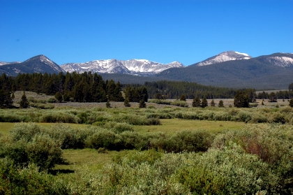 The Montana Land Use/Land Cover (LULC) Framework is a statewide, 30-meter resolution dataset of existing natural vegetation communities, based on the Group level of the National Vegetation Classification (NVC) system. It also includes mapped disturbances (e.g., pests, invasive species, fire), and human-altered lands. This dataset is best suited for broad, landscape-scale planning and general informational purposes. Due to its resolution and known limitations, it may not be appropriate for fine-scale or local analyses.
Data and Documentation
The Montana LULC dataset is adapted from a NatureServe version of NVC Group-level vegetation communities, originally derived from the LANDFIRE 2022 Existing Vegetation Type (EVT) dataset. That dataset use 30-meter Landsat multispectral imagery representing circa 2016 ground conditions under the most comprehensive mapping effort to date, LANDFIRE 2016 Remap.
The Spatial Analysis Lab and Montana Natural Heritage Program refined this dataset through expert review by vegetation ecologists familiar with Montana's plant communities. Additional non-EVT classes were added using Montana-specific datasets in 2025, including:
- 2023 Montana Department of Revenue Final Land Unit (FLU) classification
- Montana Statewide Irrigation Dataset (2018-2021)
- 2024 MSDI Transportation Framework
- LANDFIRE 2023 Historical Disturbance
- U.S. Large-Scale Solar Photovoltaic Database
- 2023 Montana Wetland and Riparian Framework
Some EVT classes were reassigned where they conflicted with species range descriptions in the Montana Field Guide. Due to the 30-meter pixel size, the data are best used at scales coarser than 1:50,000.
The LULC dataset includes three classification levels, each with a default display scale - but any level can be viewed at any scale:
- Level 1 (beyond 1:2,000,000): 8 broad categories based on vegetative physiognomy
- Level 2 (1:2,000,000 to 1:200,000): 28 categories incorporating elevation and climate
- Level 3 (closer than 1:200,000): 75 unique values corresponding to NVC Groups or other land cover classes
Access the Data
Web Service
Download
- Montana Land Cover Framework (2025)
Downloadable data are available statewide in ESRI file geodatabase and GeoTIFF formats, using the Montana State Plane NAD83 (2011) Coordinate System.
Metadata
- Montana Land Cover Framework (2025)
For more information on the Land Use/Land Cover categories used in the Montana Land Cover Framework and crosswalks between NVC Groups and Ecological Systems, see Application of the National Vegetation Classification Standard in Montana and the Montana Ecological Communities Field Guide.
Archived Land Use / Land Cover Datasets
Earlier LULC datasets (2010-2017, 2023) used Ecological Systems as map units. The transition to NVC Groups enables assignment of global and subnational conservation status ranks (via NatureServe methodology) and aligns with broader vegetation mapping efforts undertaken across North America by NatureServe and NatureServe network member programs.
Archived datasets include:
- Montana Land Cover Framework (2023) - based on circa 2016 conditions
- Montana Landcover Framework (2010-2017) - based on circa 2001 conditions
Updates made for the 2023 LULC framework are described in this Land Cover Story Map. Routine updates during these periods included burned areas, agriculture, transportation, structures, insect-killed forests, and introduced vegetation. For more information on the Land Use/Land Cover categories used, see: Archived Field Guide Accounts for Ecological Systems.
Archived Downloads
Archived Metadata
Related Data
The Montana Ecogroups were developed under the 2023 Land Cover effort and based on the USDA-NRCS Major Land Units (MLRAS); the USFS Ecological Unit Hierarchy; the EPA Ecoregions; and the HU8, HU6 and Basins level of Hydrologic Unit mapping.
Applications
The Land Cover task in the Montana Natural Heritage Program's Natural Heritage Map Viewer is an interactive mapping application that allows users to view and explore the Montana LULC statewide. Users can:
- Query individual pixels
- Summarize LULC acreage and percentages by a jurisdiction or custom area
- Download reports and spreadsheets for use in environmental review, permitting, and planning
Links to the Ecological Communities Guide in the Montana Field Guide provide descriptive accounts for each LULC class. Users can also access a variety of other statewide map layers and view over 16,000 geo-referenced photos of habitats taken during wildlife and vegetation surveys across Montana.
The Ecological Site Reviewer (ESR) is an ArcGIS Online web application that displays biophysical data such as soils, elevation, slopes, aspect, frost-free days, landscape-level ecological units, ecological sites, classified vegetation and background locational data. It supports:
- Navigation to areas of interest
- Preliminary site evaluation
- Environmental attribute assessment
- Map generation and data layer feedback
Theme Lead
Jessica Mitchell
Spatial Analysis Lab Director
jessica.mitchell@mso.umt.edu
(406) 544-9256 (mobile)
