Elevation Data
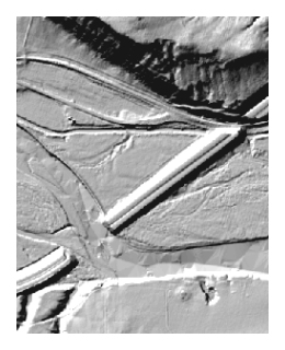 These elevation data sets were derived from LiDAR data collected in 2004 by Merrick and Company and in 2007 by Woolpert, Inc. The data are available as raster Digital Elevation Models (DEMs) and as Triangulated Irregular Networks (TIN) in two different formats.
Raster Digital Elevation Models
These Digital Elevation Models are stored in TIFF format and have a horizontal spacing of 2.5 meters.
- Sweet Grass County (2007)
- Stillwater County (2004)
- West half of Yellowstone County (2004)
- East half of Yellowstone County (2004)
- Treasure County (2007)
- Rosebud County (2007)
- Custer County (2007)
- Prairie County (2007)
- Dawson County (2004)
- Richland County (2007)
- McKenzie County (2007)
TIN Elevation Data
Triangulated Irregular Network (TIN) data are available in two formats. The data files are large, ranging in size from 200 to 1,600 megabytes. If these files are too large for you to download, please submit a request and we will send you the data.
TIN Elevation Data, ESRI TIN Format
- Sweet Grass County (2007)
- Stillwater County (2004)
- West half of Yellowstone County (2004)
- East half of Yellowstone County (2004)
- Treasure County (2007)
- Rosebud County (2007)
- Custer County (2007)
- Prairie County (2007)
- Dawson County (2004)
- Richland County (2007)
- McKenzie County (2007)
TIN Elevation Data, ESRI Generate Format
- Sweet Grass County (2007)
- Stillwater County (2004)
- West half of Yellowstone County (2004)
- East half of Yellowstone County (2004)
- Treasure County (2007)
- Rosebud County (2007)
- Custer County (2007)
- Prairie County (2007)
- Dawson County (2004)
- Richland County (2007)
- McKenzie County (2007)
Yellowstone Clearinghouse Home
Yellowstone River Final Reports
- Cumulative Effects Analysis (CEA)
- CEA Technical Appendices
- CEA Executive Summary
- Reach Narratives
- Recommended Practices and Position Statements
- Governor's Upper Yellowstone Task Force (1997-2003)
Maps
- Online Map Viewer
- Reach Story Map 1: Overview
- Reach Story Map 2: Details
- Yellowstone Reference Maps
- Maps Selected from Technical Reports
Data and Technical Reports
- Imagery and Topographic Mapping
- Hydrology and Hydraulics
- Land Use and Physical Features
- Geomorphology
- Biology
- Socioeconomics
- List of Available GIS Data
Contact Info
