2-foot Contours, Shapefile Format Central Flathead Valley
These data are 2-foot topographic contours of the Flathead Basin, including the Flathead Valley north of Flathead Lake and the immediate areas around Whitefish Lake, Flathead Lake, Swan Lake, and Polson. These contours were derived by automated methods from LiDAR point cloud data collected between September 22 and September 29, 2009.
These data are in Montana State Plane coordinates, NAD83, HARN. The horizontal units of the coordinate system are U.S. Survey Feet. The vertical datum is NAVD 88, Geoid03.
These data are in ESRI Shapefile format and are a simplified version of the original data which had many areas where there were several vertices per linear foot along the contour lines on the ground. These data have been smoothed to reduce the number of vertices by over 50 percent, while assuring that no contour line deviates by more than 1.5 inches from the position of the original. The original data, in ESRI File Geodatabase Format, are available here.
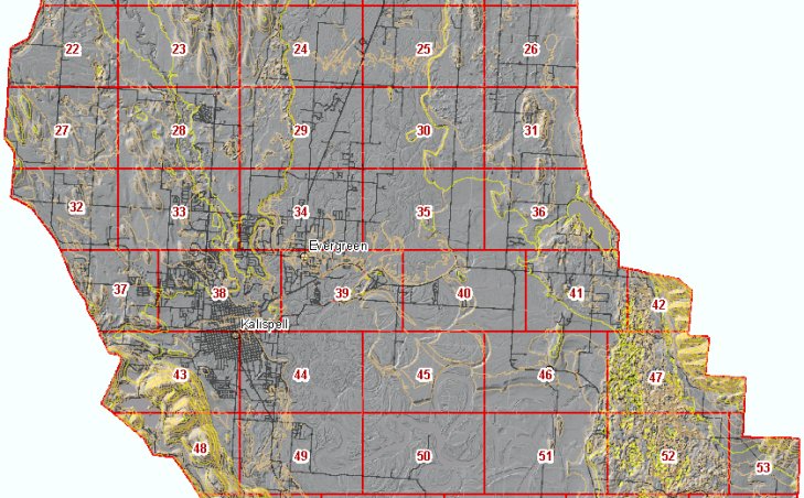
The data consists of 106 individual files that each cover about 3800 acres. Right-click on a box in the map left below and use your browser's "Save Target As" function to download the contours for that area.
Shapefile index of downloadable files
These data may be viewed by anyone with our Online Map Viewer or accessed as web services that allow seamless access to the data without the need to download individual tiles. This web site is intended for quick access to data for a small area. If you need this data for a large area sent to you, please contact the State Library.
