Giant Map of Montana Trunk
What is the Giant Map of Montana Trunk?
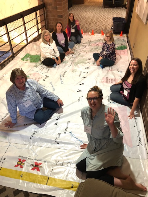
The Giant Map of Montana Trunk contains a 21’ x 15’ map of the state of Montana that people can walk on (no shoes, please!), explore, and have fun with! This educational tool has endless possibilities for learning opportunities, especially in geography and map-reading, and anyone is welcome to submit a request to borrow it. The Montana State Library has TWO copies of the map trunk that we would like to share with libraries across the state for patrons to use and enjoy.
These maps were given to us back in 2019 by University of Montana's Geographic Alliance. Thank you MGA!
What is in the Giant Map of Montana Trunk?
Click on the following links to see what the map comes with.
- Map Trunk Picture
- Map Trunk Binders
- Map Trunk Materials
- Lesson Plan Handbook PDF
- Giant Map of Montana Picture PDF
- Montana Giant Map Key
Additional Information
Here is some more information about the Giant Maps from National Geographic, as well as on geography resources in general:
- Frequently Asked Questions
- Full Price Sheet of all available Nat Geo Maps
- Nat Geo: Giant Maps General Info Page
- National Geographic Educational Resources Presentation (PDF)
- University of Montana Geography Alliance Presentation (PDF)
- Montana State Library GIS Resources and Grants Presentation (PDF)
- Land Information Act Grant Program Webpage
- Part of the GIS division within the Montana State Library
- Awards grants each year for GIS programming
- Application period is January 15 - February 15 each year
- MAGIP Grant Program for Educators Webpage
- MAGIP offers grants to K-12 educators to support GIS-related curriculum
How do I borrow/use a trunk?
Visit the MSL Trunk Program Page for more information on who can borrow a trunk, and what the expectations are for using a trunk!
